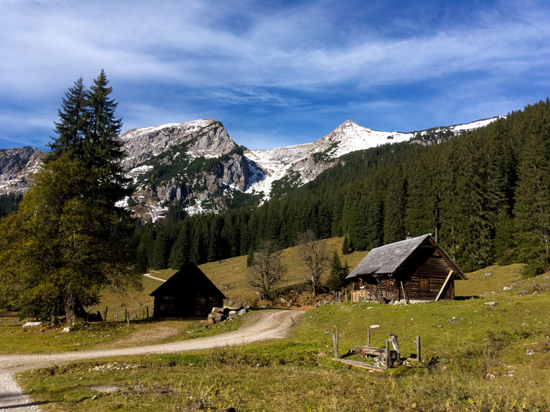
Schneealpe is a mountain massif in the Mürzsteger Alps, on the border of Styria and Lower Austria. Thanks to the high-altitude parking lot (1450 m above sea level), after just an hour and a half of hiking you can enjoy breathtaking views from the plateau. It's an ideal option for families with children and anyone who wants to experience alpine vistas without hours of climbing!
High-Altitude Parking - The Key to Success
The biggest advantage of Schneealpe is the ability to drive on a private road all the way up to an altitude of 1450 meters. While you do have to pay 10 euros for access, believe me - it's worth it! This saves us a long ascent and allows us to focus on the best part - walking across the beautiful plateau. The route totals 8.6 kilometers and takes about 3 hours. The elevation gain is only 400 meters, making it accessible to virtually everyone. The highest point we'll reach is 1783 meters above sea level.
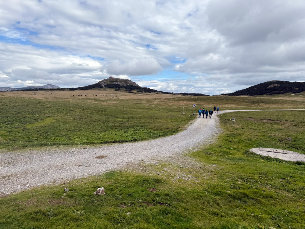
in the distance on the right side you can see Heukuppe, the highest point of the Rax massif
Breathtaking Views
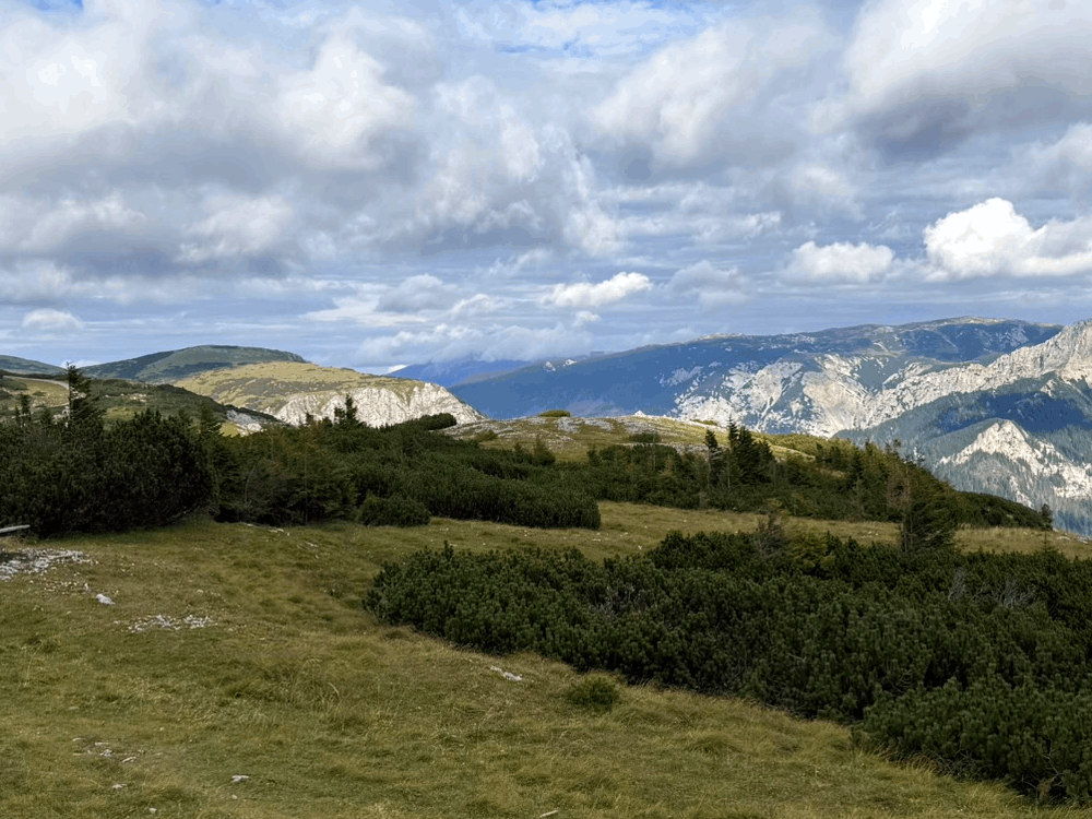
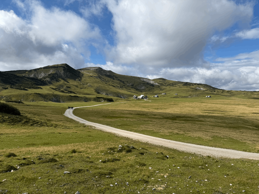
Already during the ascent from the parking lot to the plateau, we're accompanied by magnificent views. Particularly impressive is the view of the majestic Rax, which proudly towers over the area. After an hour and a half of hiking, we reach the plateau and here begins a real feast for the eyes. Vast grassy expanses alternate with rock formations. In the distance, you can see the peaks of the Vienna Alps, and the air is so clear that visibility reaches dozens of kilometers.
Schneealpenhaus - The Perfect Place to Rest
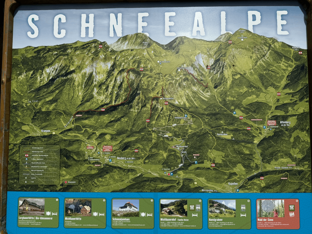
After reaching the plateau, we arrived at Schneealpenhaus - a mountain hut located at an altitude of 1784 meters. It's the perfect place to rest and recharge before continuing your hike. We filled our stomachs with delicious alpine specialties and set off with renewed energy. The hut is an excellent reference point - trails radiate from here in different directions, and on the information board you'll find a panoramic map of the entire region to help you plan your route.
Walking Across the Plateau
From the Schneealpenhaus hut, you can set out to conquer the summit of Windberg (1903 m above sea level) - about 40 minutes of additional hiking. However, we decided on a leisurely walk across the plateau. This is a fantastic option, especially if you're hiking with children or elderly people. The terrain is gentle and friendly, and the views are truly spectacular. The Schneealpe plateau is a unique place - vast grassy meadows and characteristic limestone formations add alpine character to the landscape. It's worth paying attention to the numerous karst valleys - according to local legends, snow persists in them almost throughout the summer, hence the name Schneealpe (Snowy Alps).
Geological Curiosities
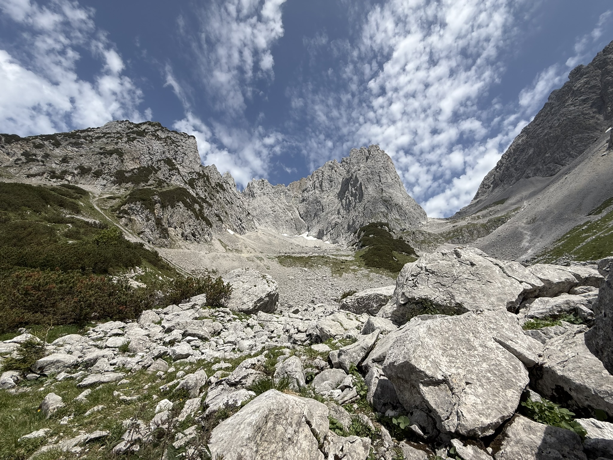
Schneealpe is a fascinating place not only for tourists but also for geology enthusiasts. The massif is mainly composed of Triassic limestone and dolomite, which form characteristic karst formations. Particularly interesting are the spectacular walls of Donnerwand and Zäunlwand. This region is part of Vienna's water supply system - the Schneealpenstollen runs through the massif, a tunnel excavated between 1965-1968 that transports drinking water to Austria's capital. This is precisely why the entire area is so carefully protected.
More Possibilities If you have more time and energy, Schneealpe offers plenty of opportunities to extend your hike. In addition to the already mentioned Windberg, you can head to other huts on the plateau - for example, to Hinteralmhaus located on the western edge of the plateau. For more demanding hikers, trails are available leading to Nassköhr or to Nasskamm, which connects Schneealpe with Rax. In the area, there are also several alpine huts where you can taste local specialties and feel the authentic atmosphere of alpine life.
In Summary
Schneealpe is the perfect place for a family mountain adventure. The proximity to Vienna (about 1.5 hours drive), high-altitude parking, and easy access to the plateau make this trail an ideal choice for a quick autumn hike. If the days are longer, the number of trails on the plateau and the Windberg summit provide an adequate amount of mountain experiences even on longer days. Technical parameters of the route - 8.6 km in length, 400 meters of elevation gain, and 3 hours of hiking - make this an option accessible to most hikers. Discover the beauty of Schneealpe!
This is a simplified elevation profile showing the highest and lowest points of the trail. For a detailed GPS-tracked elevation profile, please use a dedicated hiking app.