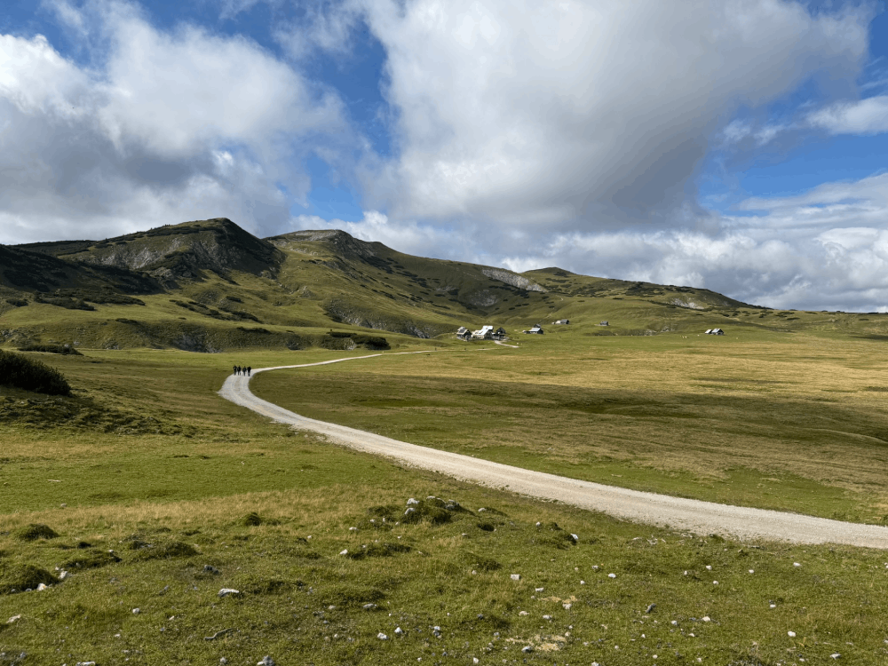
Tauplitzalm: Hiking Through an Alpine Botanical Garden

7h 50m
Duration
24.2 km
Distance
929 m
Ascent
929 m
Descent
Medium 7h 50m 24.2 km 1447 - 1926 m

Description

Salzkammergut is a region with a rich history, incredible lakes and beautiful mountains. My boots are already heating up hearing that name. Tauplitzalm is a plateau located in the east of this land. It makes an interesting destination both in winter and summer. Find out why in the rest of this post! If you want to jump straight to the reports from individual days, you can do so here: 
Tauplitzalm is located at an altitude of 1600 to 2000 meters above sea level. You can get up by cable car or by paved road from the town of Tauplitz. Tauplitz itself is 3 hours drive from Vienna.   
   People using public transport have a fairly easy access - you only need 1 transfer, and the whole journey takes about 4 hours. Details at the bottom of the post! Tauplitzalm lies on the edge of the beautiful, unusual Totes Gebirge range which has the character of a karst plateau. On the second day I tried to summit Großes Tragl. A storm prevented me from doing so, but I got above the tree line and managed to feel the incredible atmosphere of these mountains. This place holds an important place in the history of Austrian skiing - the first mountain huts and ski schools were established here as early as 1910. In 1935, one of Austria's first ski lifts was built here. This results in excellent infrastructure both in winter (currently there are 6 lifts) and summer. Numerous huts and hotels provide a varied offer, as well as moderate prices for Austria (even in the middle of the season there is no problem with spontaneously finding accommodation that won't ruin us). For larger groups I saw quite interesting offers of independent cottages up the mountain (prices from about 100 euros for a sizeable cottage, but this was 3 years ago). We stayed at the Hollhaus hut (which is more of a guesthouse), it is located at the very beginning and belongs to Alpenverein. People with a membership card can count on a discount. We didn't have one and paid about 30-35 euros per person with breakfast (it wasn't spectacular).

Day One - The 6 Lakes Circuit

After arriving and leaving our things at Hollhaus, we set off on the most popular circuit here - the 6 lakes route.
 The route leads through 6 bodies of water, not all of them deserve to be called a lake (more like a large puddle :)). It doesn't make much difference to me, because it's really beautiful! We did this route at the most beautiful time - at the end of June. And I also recommend this time to you, because that's when nature can literally stun you. Some people come to these parts specifically for the flora. The turn of June and July is the perfect moment! Tauplitzalm is often called a natural botanical garden, which is not an exaggeration at all. The meadows are literally covered with rare species of alpine flowers, their colors are striking, and the richness of scents is stunning.
Here's the first "lake" - Krallsee
We reach the first lake on our route after about 10 minutes. It's the small Krallsee. The further route leads us to the large Großsee, behind which hides the small Märchensee with very warm water - the best for swimming of all the bodies of water we'll encounter.
Tauplitzsee
The further we go, the more beautiful the lakes become. Tauplitzsee captured my heart, but actually the Steirersee, located further and a bit lower, is the highlight of the trip. But before we get there, we can have some delicious food and a beautiful view at Steirerseehütten.
view of Steirerseehütten and Steirersee
The last section of the trip - leading down to Steirersee itself - is a bit more demanding than the rest of the route. The path leads along a narrow trail with lots of roots - you need to be careful where you step. That day the temperature was very high, the stuffiness of the dense dwarf pine made the march difficult. We finally descended to Steirersee and went on to Schwarzensee, whose shore was occupied by cows. If you feel like it and have time, you can go further to Leistenalmhütte. That's 5km and about 1.5h of additional hiking. We preferred to spend this time on a picnic and a swim in Steirersee.   
And this is what a great spot for a refreshing swim at the end of Steirersee looks like
It's worth mentioning that despite the peak season and hot weather, we were alone on the trail most of the time. After resting, we gathered ourselves for the return journey to Hollhaus. It was a delightful day!   

Day Two - Attempt to Summit Großes Tragl, Thwarted by a Storm

Being impressed by the beauty of the first day, we gathered fairly early and decided to summit Großes Tragl, a beautiful viewpoint peak at 2163 m above sea level. The weather was muggy, just like the day before, but our mood and motivation pushed us forward. The route leads to Steirerseehütten, but this time we don't descend to the lake, but follow the signs and take the trail to the left, uphill.
This is a view of Sturzhahn, a beautiful peak. There's an interesting via ferrata there with difficulty C
Here, unlike the first day, the elevation gain is greater. Which combined with the stuffiness of the dense coniferous forest was tiring, but after about half an hour we left the tree line behind and entered the unique landscape of Totes Gebirge.
You need to be very careful where you place your feet
 Anyone who has been in this area at least once knows what I'm talking about. Those who haven't been can see it in the photos, but as always they don't convey that atmosphere in the slightest degree compared to reality.   
When hiking in Totes Gebirge, you need to carefully observe the trail so as not to lose it. Going off the trail here is a very dangerous matter - the character of these mountains means that there are very deep crevices everywhere.   
Unfortunately, we were not destined to see the famous panorama from the summit, as we had to turn back from an altitude of about 1900 m above sea level due to an approaching summer storm. But even so, the impressions were incredible and you could feel the atmosphere of these mountains. This was my first contact with Totes Gebirge. Not the last one, of course :)   

Technical Specifications

Difficulty Medium
Duration 7h 50m
Length 24.20 km
Ascent 929 m
Descent 929 m
Highest Point 1926 m
Lowest Point 1447 m
Region Steiermark
Country AT

Coordinates

Starting Point

Hollhaus

Latitude: 47.594283
Longitude: 13.985700

Ending Point

Hollhaus

Latitude: 47.594283
Longitude: 13.985700

Trail Stages

Stage 1

Stage Number 1
Duration 4h
Length 13.00 km
Ascent 366 m
Descent 366 m
Highest Point 1663 m
Lowest Point 1447 m
Outdooractive Outdooractive Link
Coordinates
Starting Point

Hollhaus

Latitude: 47.594283
Longitude: 13.985700

Ending Point

Hollhaus

Latitude: 47.594283
Longitude: 13.985700


Stage 2

Stage Number 2
Duration 3h 50m
Length 11.20 km
Ascent 563 m
Descent 563 m
Highest Point 1926 m
Lowest Point 1543 m
Outdooractive Outdooractive Link
Coordinates
Starting Point

Hollhaus

Latitude: 47.594283
Longitude: 13.985700

Ending Point

Hollhaus

Latitude: 47.594283
Longitude: 13.985700

Trail Location

Starting Point

Latitude: 47.594283
Longitude: 13.985700

Open in Google Maps
Ending Point

Latitude: 47.594283
Longitude: 13.985700

Open in Google Maps

Elevation Profile

929 m

Total Ascent

929 m

Total Descent

1926 m

Highest Point

1447 m

Lowest Point
This is a simplified elevation profile showing the highest and lowest points of the trail. For a detailed GPS-tracked elevation profile, please use a dedicated hiking app.

Share this trail

You might also like